



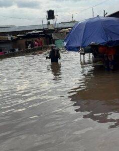
A total of 246 areas in Nairobi County of Kenya have been identified as potential hotspots to experience severe flooding during the October-December short rains seasons, the Kenya Meteorological Service Authority has warned.
A In a statement issued on Monday, the authority said the country will experience above-average and wetter-than-normal weather conditions due to El Nino phenomenon which is anticipated to affect most African countries between October 2026 and February 2027.
The authority said up to 100,000 households across 240 areas in Nairobi country would be affected, underscoring the need to establishing rescuing team and preparing emergency lines, boats, and relief support. According to Nairobi County Chief Officer in charge of Disaster Management Bramwel Simiyu, the county has embarked on clearing drainage and all waterways to ensure that there is no blockage to the storm water.
Some of the major roads which are to experience floods includes Uhuru Highway, Jogoo Road, Kangundo Road, Thika Road, and some roads in Westlands. “Our focus is on mitigation and preparation at this point in time but also preparing our response perspective to be ready, and in the worst case scenario, to help those who will be affected, “Simiyu said.
Among the hotspot areas which require humanitarian impact includes Mukuru informal settlements and the Industrial Area corridor which is made up of Pipeline, Imara Daima, and Kware.
Kenyans have been asked to continue observing evacuation and safety instructions, avoid walking or driving through floodwater, and rely on information issued by the Ministry of Health, county governments and authorized emergency agencies.
MG/abj/APA